What has been driving recent tropical forest loss? A new Geo-Wiki campaign tries to elucidate the answer
We are excited to announce that as part of the LOT 1 project IIASA has started a new crowdsourcing campaign to help us understand and map the drivers of forest loss across the Tropics. The Geo-Wiki campaign will contribute to a more accurate mapping of the drivers of forest loss in the tropics. This is crucial to guide policies that can protect tropical forests, not only the most biodiverse areas of our planet but also buffers to the ever-increasing effects of climate change.
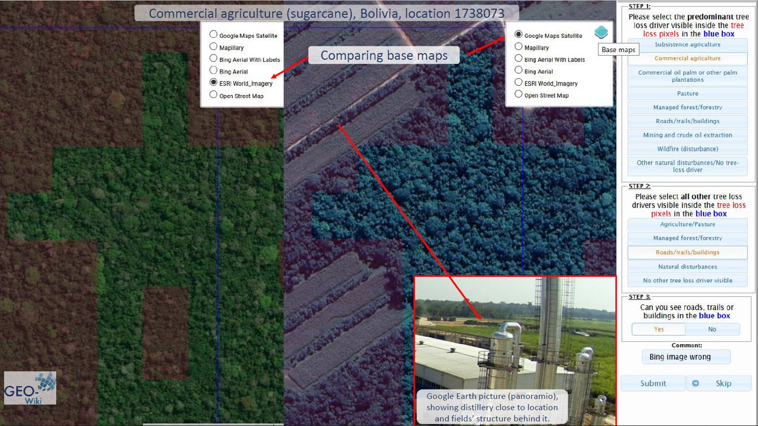
As a participant of the campaign you will be asked to do a bit of detective work: Find out what happened to areas that had tree-cover before 2008. Using a combination of very high-resolution imagery, you can figure out what was the cause of the tree-loss. We will aim to classify 150K locations during the campaign, which will launch at the beginning of December.
Mark your calendar and join the campaign, which will include monetary prizes, but also, if you can provide lots of good quality data, you can opt-in to co-write with us a scientific paper describing the findings of the campaign.
The campaign will be very much focused on data quality, so be very careful with your answers so you can get ahead in the game!
For more information check out the YouTube channel as well as a news article. Join the campaign by going to the Geo-Wiki website (https://www.geo-wiki.org), click on Launch and select the Drivers of Tropical Forest Loss branch. You can also click here to go directly to the login page.